
Payl:RepublicanRiver1947.jpg
Gidak-on ning maong paunang tan-aw: 800 x 442 ka mga piksel. Uban pang mga resoluyon: 320 x 177 ka mga piksel | 640 x 354 ka mga piksel | 1,024 x 566 ka mga piksel | 1,280 x 707 ka mga piksel | 2,560 x 1,415 ka mga piksel | 4,039 x 2,232 ka mga piksel.
Tibuok resolusyon (4,039 × 2,232 pixels, size sa payl: 700 KB, MIME type: image/jpeg)
Mubong sugid:
| Deskripsyon |
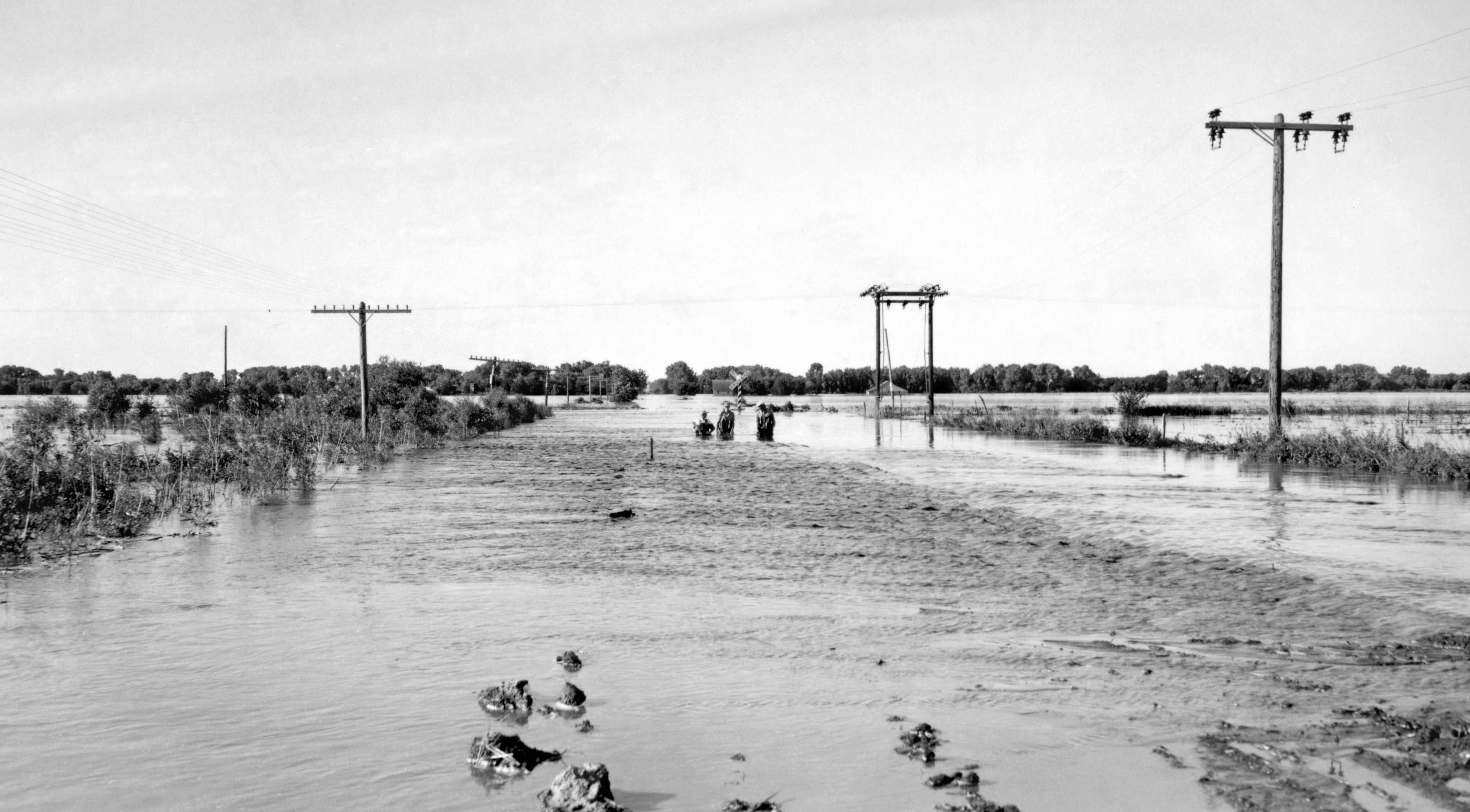
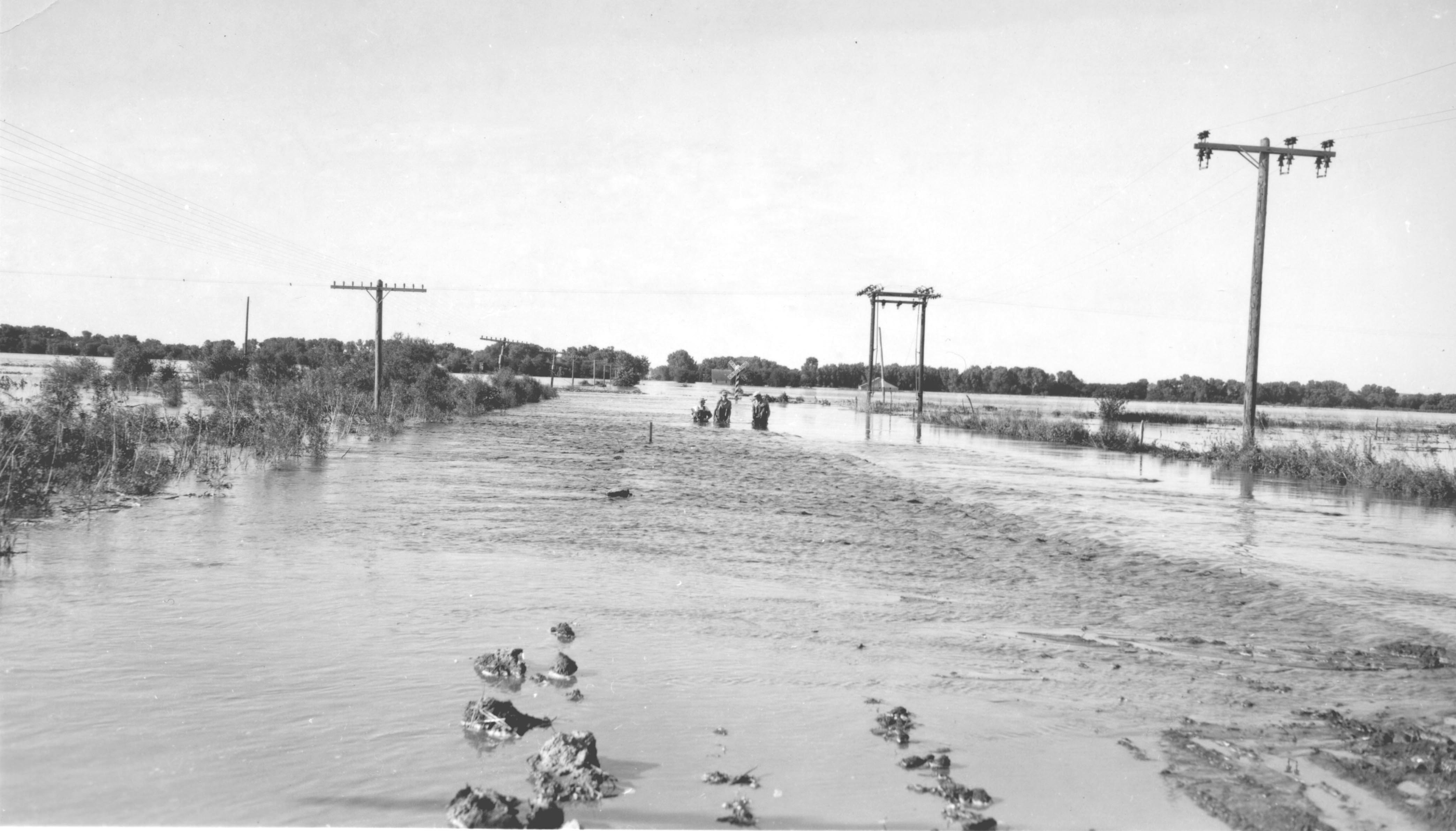
English: June 24, 1947 flood of the Republican River on the border of Jewell County, Kansas and Republic County, Kansas near Hardy, Nebraska and Webber, Kansas, just south of Nebraska NE-8 on Kansas 1 Rd/CR-1 bridge over the Republican River. The normal flood stage for the river is at the tree line in the foreground. |
| Petsa | Taken on 24 Hunyo 1947 |
| Gigikanan | USGS Surface Water Photo Gallery, item 18 09 |
| Tagsulat | J.G. Connor (submitted to USGS by Steve Blanchard, OSW) |
Pagtugot
This image is in the public domain in the United States because it only contains materials that originally came from the United States Geological Survey, an agency of the United States Department of the Interior. For more information, see the official USGS copyright policy.
|
Original upload log
The original description page was here. All following user names refer to en.wikipedia.
- 2008-09-04 00:03 Suntag 4176×2384× (607863 bytes)
Kaagi sa payl
I-klik ang petsa/oras aron makit-an ang hulagway sa payl niadtong panahona.
| Petsa/Takna | Thumbnail | Mga dimensyon | Tiggamit | Komento | |
|---|---|---|---|---|---|
| kasamtangan | 22:21, 26 Septiyembre 2013 | | 4,039 × 2,232 (700 KB) | Centpacrr | Rotate 2.5º CCW & crop; adjust gamma; "flyspeck" and otherwise cleanup image |
| 19:15, 31 Disyembre 2008 |  | 4,176 × 2,384 (594 KB) | Urdangaray | {{Information |Description={{en|June 24, 1947 flood of the en:Republican River on the border of en:Jewell County, Kansas and en:Republic County, Kansas near en:Hardy, Nebraska and en:Webber, Kansas, just south of Nebraska NE-8 on |
Mga paggamit sa payl
Ang mosunod nga mga panid misumpay niining payl:
Global nga paggamit sa payl
Kining ubang wiki naggamit ning maong payl:
- Paggamit sa arz.wikipedia.org
- Paggamit sa chy.wikipedia.org
- Paggamit sa de.wikipedia.org
- Paggamit sa en.wikipedia.org
- Paggamit sa es.wikipedia.org
- Paggamit sa fr.wikipedia.org
- Paggamit sa incubator.wikimedia.org
- Paggamit sa ja.wikipedia.org
- Paggamit sa simple.wikipedia.org
- Paggamit sa www.wikidata.org