
Payl:Romania Galati Location map.jpg
Gidak-on ning maong paunang tan-aw: 527 x 599 ka mga piksel. Uban pang mga resoluyon: 211 x 240 ka mga piksel | 422 x 480 ka mga piksel | 640 x 728 ka mga piksel.
Tibuok resolusyon (640 × 728 pixels, size sa payl: 77 KB, MIME type: image/jpeg)

|
This map image could be re-created using vector graphics as an SVG file. This has several advantages; see Commons:Media for cleanup for more information. If an SVG form of this image is available, please upload it and afterwards replace this template with
{{vector version available|new image name}}.
It is recommended to name the SVG file “Romania Galati Location map.svg”—then the template Vector version available (or Vva) does not need the new image name parameter. |


Mubong sugid:
| Deskripsyon |
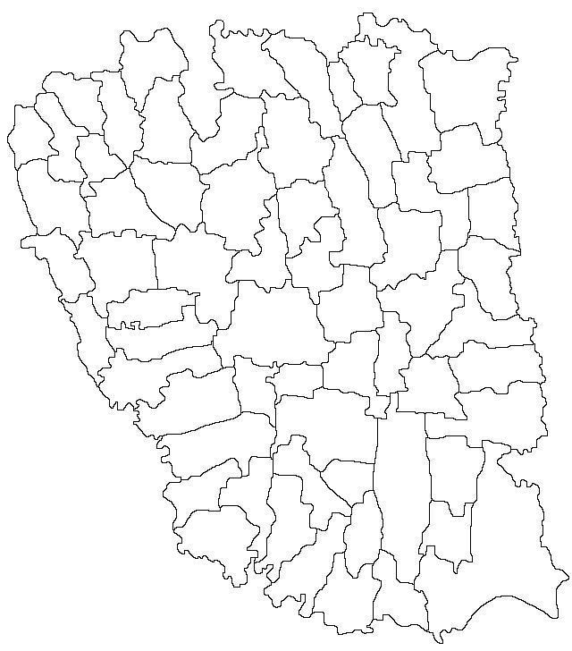
English: Map of Galati County with limits of communes |
| Petsa | |
| Gigikanan | Derivative of file Harta jud Galati.png |
| Tagsulat | Radufan |
Pagtugot
This file is licensed under the Creative Commons Attribution-Share Alike 3.0 Unported license.
- Libre ka:
- sa pagsabwag – sa pagkopya, pag-apod-apod ug pagsabwag sa hinimo
- sa pag-remix – sa pag-adap sa binuhat
- Ubos sa mosunod nga mga kondisyon:
- atribusyon – Kinahanglan nimo nga hatagan ang angay nga kredito, maghatag usa ka link sa lisensya, ug ipakita kung adunay mga pagbag-o. Mahimo nimo kini buhaton sa bisan unsang makatarunganon nga paagi, apan dili sa bisan unsang paagi nga nagsugyot nga gi-endorso ka sa licensor o ang imong paggamit.
- share parehas – Kung imong gi-remix, gibag-o, o gibase sa materyal, kinahanglan nimo nga iapod-apod ang imong mga kontribusyon sa ilawom sa parehas o katugma nga lisensya sama sa orihinal.
Kaagi sa payl
I-klik ang petsa/oras aron makit-an ang hulagway sa payl niadtong panahona.
| Petsa/Takna | Thumbnail | Mga dimensyon | Tiggamit | Komento | |
|---|---|---|---|---|---|
| kasamtangan | 02:06, 30 Abril 2013 | | 640 × 728 (77 KB) | Afil | Updated limits of communes. Derivative of existing map on Wikicommons |
| 23:07, 15 Nobiyembre 2011 |  | 640 × 728 (75 KB) | Afil |
Mga paggamit sa payl
Ang mosunod nga mga panid misumpay niining payl:
Global nga paggamit sa payl
Kining ubang wiki naggamit ning maong payl:
- Paggamit sa ar.wikipedia.org
- Paggamit sa en.wikipedia.org
- Paggamit sa fr.wikipedia.org
- Paggamit sa he.wikipedia.org
- Paggamit sa kn.wikipedia.org
- Paggamit sa pl.wikipedia.org
- Gałacz
- Tecuci
- Târgu Bujor
- Berești
- Stadion Oțelul
- Moduł:Mapa/dane/Gałacz
- Moduł:Mapa/dane/RO-GL
- Galați (stacja kolejowa)
- Barcea
- Podoleni
- Bălăbănești (okręg Gałacz)
- Burscucani
- Lungești (okręg Gałacz)
- Zimbru (okręg Gałacz)
- Bălășești (okręg Gałacz)
- Ciurești (okręg Gałacz)
- Ciureștii Noi
- Pupezeni
- Băleni (okręg Gałacz)
- Băneasa (okręg Gałacz)
- Roșcani (okręg Gałacz)
- Berești-Meria
- Aldești (okręg Gałacz)
- Balintești
- Onciu
- Pleșa (okręg Gałacz)
- Prodănești (okręg Gałacz)
- Puricani
- Săseni (okręg Gałacz)
- Slivna (okręg Gałacz)
- Șipote (okręg Gałacz)
- Brăhășești
- Corcioveni
- Cosițeni (okręg Gałacz)
- Toflea
- Braniștea (okręg Gałacz)
- Lozova (okręg Gałacz)
- Traian (okręg Gałacz)
- Vasile Alecsandri (okręg Gałacz)
- Buciumeni (okręg Gałacz)
- Hănțești (okręg Gałacz)
View more global usage of this file.