
Payl:Seychelles location map.svg

Size of this PNG preview of this SVG file: 711 x 600 ka mga piksel. Uban pang mga resoluyon: 285 x 240 ka mga piksel | 569 x 480 ka mga piksel | 910 x 768 ka mga piksel | 1,214 x 1,024 ka mga piksel | 2,428 x 2,048 ka mga piksel | 1,087 x 917 ka mga piksel.
Tibuok resolusyon (SVG nga payl, nominally 1,087 × 917 pixels, size sa payl: 80 KB)
Mubong sugid:
| Deskripsyon |
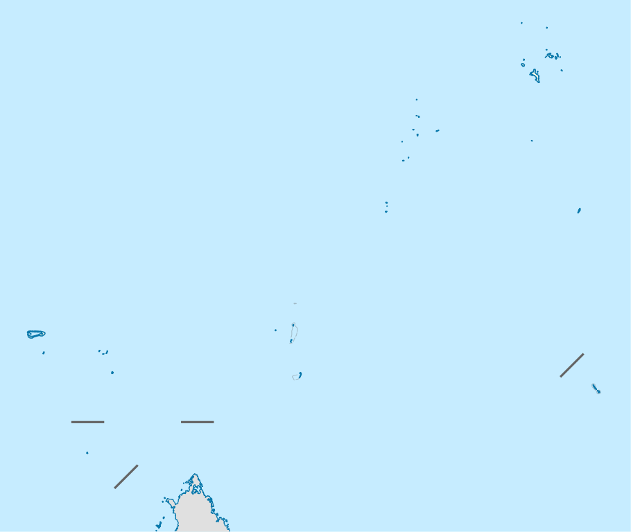
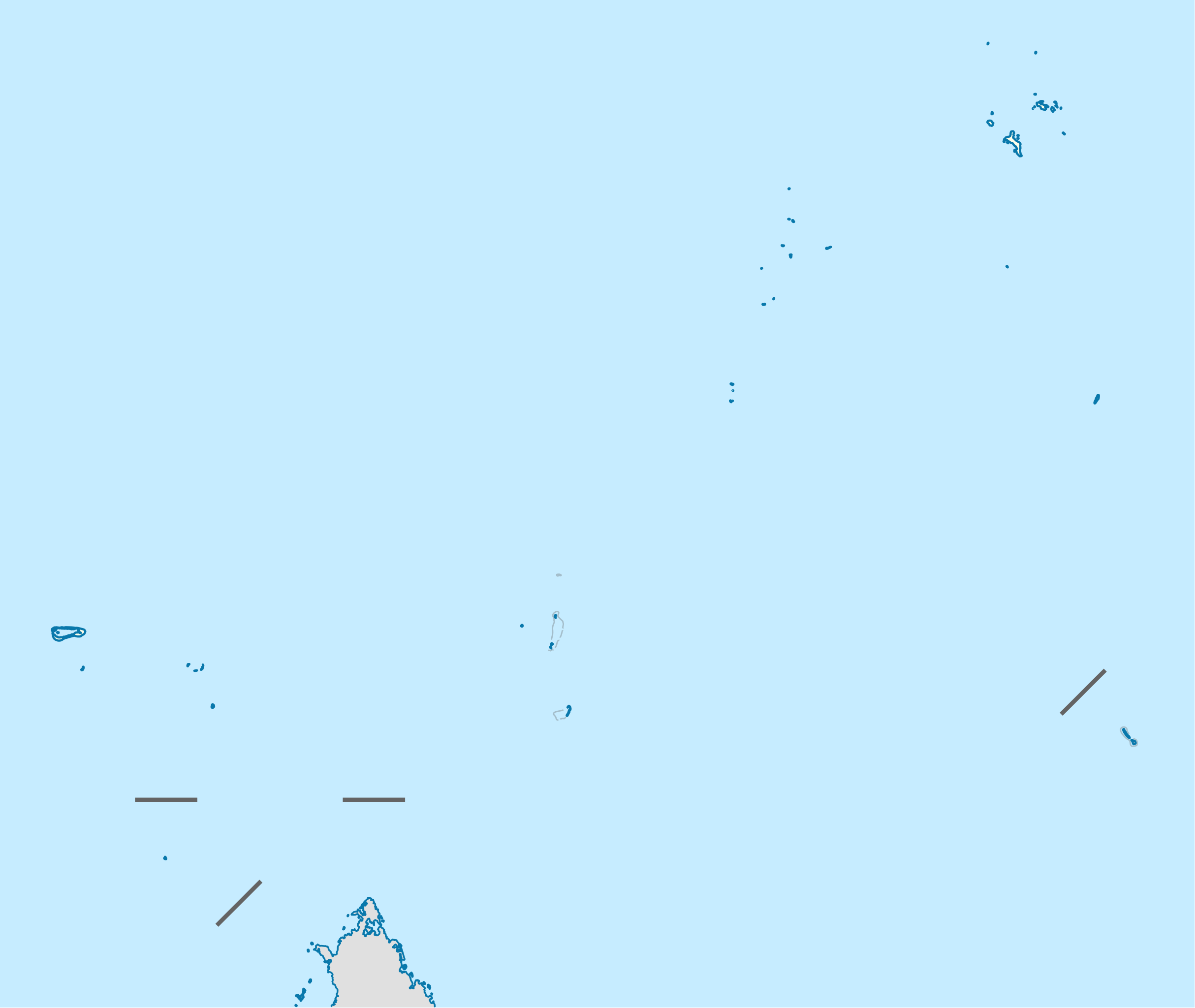
Deutsch: Positionskarte der Seychellen
Quadratische Plattkarte. Geographische Begrenzung der Karte:
English: Location map of Seychelles
Equirectangular projection. Geographic limits of the map:
|
| Petsa | |
| Gigikanan | Kaugalingong trabaho, using United States National Imagery and Mapping Agency data |
| Tagsulat | NordNordWest |
| Pagtugot (Paggamit pag-usab niini nga file) |
I, the copyright holder of this work, hereby publish it under the following license: This file is licensed under the Creative Commons Attribution-Share Alike 3.0 Unported license.
|

|
This map has been made or improved in the German Kartenwerkstatt (Map Lab). You can propose maps to improve as well.
|
Kaagi sa payl
I-klik ang petsa/oras aron makit-an ang hulagway sa payl niadtong panahona.
| Petsa/Takna | Thumbnail | Mga dimensyon | Tiggamit | Komento | |
|---|---|---|---|---|---|
| kasamtangan | 14:55, 20 Oktubre 2009 | | 1,087 × 917 (80 KB) | NordNordWest | {{int:filedesc}} {{Information |Description= {{de|Positionskarte der Seychellen}} Quadratische Plattkarte. Geographische Begrenzung der Karte: * N: 3.3° S * S: 13.0° S * W: 45.7° O * O: 57.2° O {{en|Location map of [[:en:Seychelles| |
Mga paggamit sa payl
More than 100 pages use this file. The following list shows the first 100 pages that use this file only. A full list is available.
- Baie Chevalier
- Bat Island
- Bayonne (pagklaro)
- Beacon Island
- Bel Air
- Bird
- Bird Island
- Buxton
- Caiman (pagklaro)
- Cascade Point
- Cascade River
- Castle Hill
- Castle Peak
- Chevalier Bay
- Chevalier Point
- Chimney Rocks
- Cocoanut Island
- Conception Island
- Conical Hill
- Connan
- Cousin Island
- Dennis Island
- Eagle Island
- East Channel
- East Sister Island
- English River
- Findlay
- Grande Anse
- Great Pass
- Hangard (pagklaro)
- Harrison Rock
- Hermes
- Ile Plate
- Ile Ronde
- Ile du Nord
- L'Etoile
- L'Ilot
- L'Îlot
- La Digue
- La Passe
- Le Grand Rocher
- Les Mamelles
- Les Sœurs
- Les Trois Freres
- Long Island
- Mahe
- Mahé
- Main Channel
- Mamelles
- Mary Anne Island
- Middle Island
- Millers Point
- Morne Blanc
- Mount Harrison
- Mount Howard
- Mount Lockyer
- Mount Simpson
- Moussa
- North Hill
- North Island
- North Islet
- North Point
- North West Bay
- Oliver Hill
- Pelican Island
- Petite Ile
- Petite Île
- Pointe Rouge
- Pointe du Sud
- Police Point
- Port Victoria
- Poule Island
- Pyramid Rock
- Rat Island
- Recica
- Red Hill
- Rouge Point
- Round Island
- Saint Pierre
- Sand Cay
- Shark Rock
- Signal Hill
- South East Island
- South Island
- The Cousins
- The Sisters
- Victoria
- West Island
- West Sister Island
- Whale Rocks
- Wizard Reef
- Île Alphonse
- Île Cachée
- Île Denis
- Île Desroches
- Île Plate
- Île Ronde
- Île aux Cerfs
- Île aux Rats
- Île aux Vaches
View more links to this file.
Global nga paggamit sa payl
Kining ubang wiki naggamit ning maong payl:
- Paggamit sa af.wikipedia.org
- Paggamit sa am.wikipedia.org
- Paggamit sa an.wikipedia.org
- Paggamit sa ar.wikipedia.org
- Paggamit sa ast.wikipedia.org
- Paggamit sa az.wikipedia.org
- Paggamit sa be-tarask.wikipedia.org
- Paggamit sa be.wikipedia.org
- Paggamit sa bg.wikipedia.org
- Paggamit sa bn.wikipedia.org
- Paggamit sa bs.wikipedia.org
- Paggamit sa ce.wikipedia.org
- Paggamit sa ckb.wikipedia.org
- Paggamit sa cs.wikipedia.org
- Paggamit sa da.wikipedia.org
- Paggamit sa de.wikipedia.org
View more global usage of this file.