
Payl:Shiloh Wind Power Plant aerial cropped to Venice Island.jpg
Walay mas taas nga resolusyon.
Shiloh_Wind_Power_Plant_aerial_cropped_to_Venice_Island.jpg (250 × 100 pixels, size sa payl: 37 KB, MIME type: image/jpeg)
Mubong sugid:
| Deskripsyon |
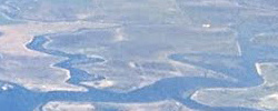
English: Aerial view from the west of the Shiloh Wind Power Plant (windfarm) in the Montezuma Hills of Solano County, California, USA, close to Bird's Landing and Collinsville, 40 miles (64 km) northeast of San Francisco. |
| Petsa | |
| Gigikanan | Kaugalingong trabaho |
| Tagsulat | Dicklyon |
| Other versions |

.jpg)
| Camera location | | View this and other nearby images on: OpenStreetMap |
|---|
Pagtugot
I, the copyright holder of this work, hereby publish it under the following license:
This file is licensed under the Creative Commons Attribution-Share Alike 4.0 International license.
- Libre ka:
- sa pagsabwag – sa pagkopya, pag-apod-apod ug pagsabwag sa hinimo
- sa pag-remix – sa pag-adap sa binuhat
- Ubos sa mosunod nga mga kondisyon:
- atribusyon – Kinahanglan nimo nga hatagan ang angay nga kredito, maghatag usa ka link sa lisensya, ug ipakita kung adunay mga pagbag-o. Mahimo nimo kini buhaton sa bisan unsang makatarunganon nga paagi, apan dili sa bisan unsang paagi nga nagsugyot nga gi-endorso ka sa licensor o ang imong paggamit.
- share parehas – Kung imong gi-remix, gibag-o, o gibase sa materyal, kinahanglan nimo nga iapod-apod ang imong mga kontribusyon sa ilawom sa parehas o katugma nga lisensya sama sa orihinal.
Kaagi sa payl
I-klik ang petsa/oras aron makit-an ang hulagway sa payl niadtong panahona.
| Petsa/Takna | Thumbnail | Mga dimensyon | Tiggamit | Komento | |
|---|---|---|---|---|---|
| kasamtangan | 06:53, 20 Marso 2021 | 250 × 100 (37 KB) | JPxG | File:Shiloh Wind Power Plant aerial (cropped).jpg cropped 86 % horizontally, 80 % vertically using CropTool with precise mode. Only shows w:Venice Island (California). |
.jpg)
Mga paggamit sa payl
Ang mosunod nga mga panid misumpay niining payl:
Global nga paggamit sa payl
Kining ubang wiki naggamit ning maong payl:
- Paggamit sa en.wikipedia.org
- Paggamit sa www.wikidata.org