
Payl:Shoreline of Lakeside from the air.jpg

Gidak-on ning maong paunang tan-aw: 800 x 600 ka mga piksel. Uban pang mga resoluyon: 320 x 240 ka mga piksel | 640 x 480 ka mga piksel | 1,024 x 768 ka mga piksel | 1,280 x 960 ka mga piksel | 2,560 x 1,920 ka mga piksel | 2,816 x 2,112 ka mga piksel.
Tibuok resolusyon (2,816 × 2,112 pixels, size sa payl: 2.04 MB, MIME type: image/jpeg)
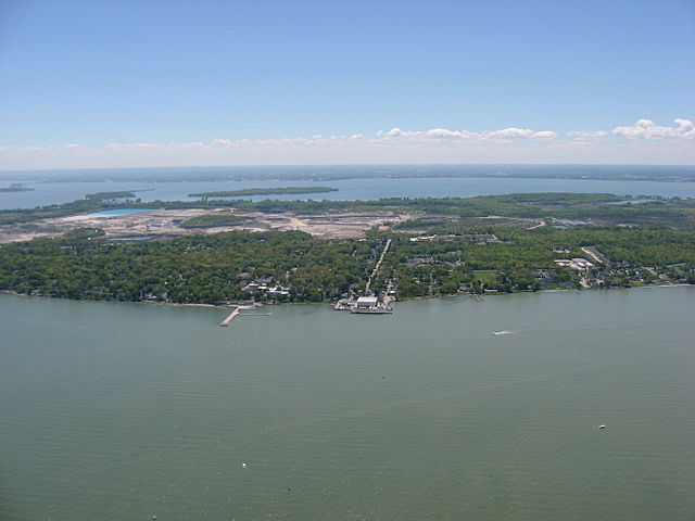
| Deskripsyon | Aerial view of Lakeside, a community in Ottawa County, Ohio, United States between Marblehead and Port Clinton. Johnson's Island is located in Sandusky Bay, in the background on the far side of the Marblehead Peninsula. Picture taken from a Diamond Eclipse light airplane at an altitude of 1,700 feet MSL and a bearing of approximately 173º. | ||
| Petsa | Taken on 24 Mayo 2008 | ||
| Gigikanan | Kaugalingong trabaho | ||
| Tagsulat | Nyttend | ||
| Pagtugot (Paggamit pag-usab niini nga file) |
|
||
| Other versions |
.jpg)
| Annotations | This image is annotated: View the annotations at Commons |
Kaagi sa payl
I-klik ang petsa/oras aron makit-an ang hulagway sa payl niadtong panahona.
| Petsa/Takna | Thumbnail | Mga dimensyon | Tiggamit | Komento | |
|---|---|---|---|---|---|
| kasamtangan | 22:16, 15 Agosto 2008 | | 2,816 × 2,112 (2.04 MB) | Nyttend | {{Information |Description=Aerial view of {{w|Lakeside, Ohio|Lakeside}}, a community in {{w|Ottawa County, Ohio|Ottawa County}}, {{w|Ohio}}, {{w|United States}} between {{w|Marblehead, Ohio|Marblehead}} and {{w|Port Clinton, Ohio|Port Clinton}}. {{w|John |
Mga paggamit sa payl
Ang mosunod nga mga panid misumpay niining payl:
Global nga paggamit sa payl
Kining ubang wiki naggamit ning maong payl:
- Paggamit sa azb.wikipedia.org
- Paggamit sa ce.wikipedia.org
- Paggamit sa en.wikipedia.org
- Paggamit sa en.wikivoyage.org
- Paggamit sa es.wikipedia.org
- Paggamit sa fa.wikipedia.org
- Paggamit sa it.wikivoyage.org
- Paggamit sa lld.wikipedia.org
- Paggamit sa pl.wikipedia.org
- Paggamit sa pt.wikipedia.org
- Paggamit sa sh.wikipedia.org
- Paggamit sa sr.wikipedia.org
- Paggamit sa tt.wikipedia.org
- Paggamit sa uk.wikipedia.org
- Paggamit sa ur.wikipedia.org
- Paggamit sa www.wikidata.org