
Payl:Spain location map.svg

Size of this PNG preview of this SVG file: 699 x 600 ka mga piksel. Uban pang mga resoluyon: 280 x 240 ka mga piksel | 559 x 480 ka mga piksel | 895 x 768 ka mga piksel | 1,193 x 1,024 ka mga piksel | 2,387 x 2,048 ka mga piksel | 1,184 x 1,016 ka mga piksel.
Tibuok resolusyon (SVG nga payl, nominally 1,184 × 1,016 pixels, size sa payl: 536 KB)
Mubong sugid:
| Deskripsyon |
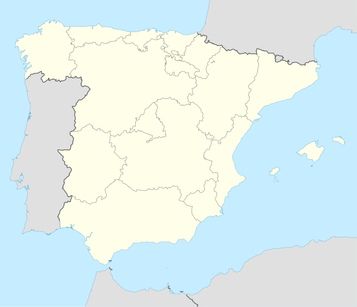
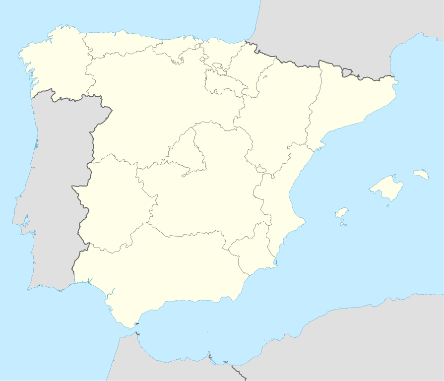
Deutsch: Positionskarte von Spanien
Quadratische Plattkarte, N-S-Streckung 130 %. Geographische Begrenzung der Karte:
English: Location map of Spain
Equirectangular projection, N/S stretching 130 %. Geographic limits of the map:
|
||
| Petsa | |||
| Gigikanan | Kaugalingong trabaho | ||
| Tagsulat | NordNordWest | ||
| Other versions |
Derivative works of this file: |
||
| SVG genesis | This locator map was created with Inkscape by NordNordWest.
|

Pagtugot
I, the copyright holder of this work, hereby publish it under the following licenses:

|
Gitugot ang pagkopya, pag-apud-apod o/ug pag-usab ning maong dokumento ubos sa mga termino sa GNU Free Documentation License, Version 1.2 o mas bag-ong bersiyon nga gimantala sa Free Software Foundation; nga walay Invariant Sections, walay Front-Cover Texts, ug walay Back-Cover Texts. Ang kopya sa lisensiya gilakip sa bahin nga giulohang GNU Free Documentation License. |
This file is licensed under the Creative Commons Attribution-Share Alike 3.0 Unported license.
- Libre ka:
- sa pagsabwag – sa pagkopya, pag-apod-apod ug pagsabwag sa hinimo
- sa pag-remix – sa pag-adap sa binuhat
- Ubos sa mosunod nga mga kondisyon:
- atribusyon – Kinahanglan nimo nga hatagan ang angay nga kredito, maghatag usa ka link sa lisensya, ug ipakita kung adunay mga pagbag-o. Mahimo nimo kini buhaton sa bisan unsang makatarunganon nga paagi, apan dili sa bisan unsang paagi nga nagsugyot nga gi-endorso ka sa licensor o ang imong paggamit.
- share parehas – Kung imong gi-remix, gibag-o, o gibase sa materyal, kinahanglan nimo nga iapod-apod ang imong mga kontribusyon sa ilawom sa parehas o katugma nga lisensya sama sa orihinal.
You may select the license of your choice.
Kaagi sa payl
I-klik ang petsa/oras aron makit-an ang hulagway sa payl niadtong panahona.
| Petsa/Takna | Thumbnail | Mga dimensyon | Tiggamit | Komento | |
|---|---|---|---|---|---|
| kasamtangan | 14:23, 7 Hulyo 2008 | | 1,184 × 1,016 (536 KB) | NordNordWest | |
| 13:58, 4 Hulyo 2008 |  | 1,184 × 1,016 (785 KB) | NordNordWest | corrected | |
| 13:54, 4 Hulyo 2008 |  | 1,184 × 1,016 (791 KB) | NordNordWest | {{Information |Description= {{de|Positionskarte von Spanien}} Quadratische Plattkarte, N-S-Streckung 130 %. Geographische Begrenzung der Karte: * N: 44.4° N * S: 34.7° N * W: 9.9° W * O: 4.8° O {{en|Location map of Spain} |
Mga paggamit sa payl
More than 100 pages use this file. The following list shows the first 100 pages that use this file only. A full list is available.
- Ador
- Ain (pagklaro)
- Allo
- Anna (pagklaro)
- Antigua
- Baga
- Berango
- Buenavista
- Burgas
- Cava
- Cerro Grande
- Cerro San Cristobal
- Cerro San Cristóbal
- Cerro Verde
- Conquista
- Cubilla
- Dolores
- East Rock
- El Castillo
- El Cerro
- El Rosario
- Granada (pagklaro)
- Isar
- Isla (pagklaro)
- Isla Grande
- Isla Redonda
- La Carolina
- La Concha
- La Cueva
- Laguna Blanca
- Laguna Grande
- Lama (pagklaro)
- Leon
- León
- Malaga
- Malda
- Montfort
- Moya (pagklaro)
- Najera
- Narros
- Nepas
- Ores
- Pego
- Peña Blanca
- Pulgar
- Punta Gorda
- Redonda
- Rio Blanco
- Rio Cua
- Rio Frio
- Rio Grande
- Rio Negro
- Rio Piedra
- Rio Piedras
- Rio San Juan
- Rio Seco
- Rio Sucio
- Rio Viejo
- Río Blanco
- Río Franco
- Río Frío
- Río Grande
- Río Negro
- Río Piedras
- Río San Juan
- Río Seco
- Río Sucio
- Río Viejo
- San Antonio
- San Fernando
- San Francisco
- San Isidro
- San Lorenzo (pagklaro)
- San Marcos
- San Nicolas
- San Nicolás
- San Pedro (pagklaro)
- San Rafael
- San Salvador
- Santa Lucia
- Santa Lucía
- Santa Maria (pagklaro)
- Santa María (pagklaro)
- Santo Domingo
- Santo Tomas
- Santo Tomás
- Silla
- Tala
- Teba
- Telica
- Toro
- Valga
- Victoria
- Villanueva
- Viso
- Yanguas
- Gumagamit:Lsjbot/geotest/Cap de la Serra (pagklaro)
- Gumagamit:Lsjbot/geotest/Riu Sec (pagklaro)
- Gumagamit:Lsjbot/geotest/Sant Marti (pagklaro)
- Gumagamit:Lsjbot/geotest/Sant Martí (pagklaro)
View more links to this file.
Global nga paggamit sa payl
Kining ubang wiki naggamit ning maong payl:
- Paggamit sa ace.wikipedia.org
- Paggamit sa af.wikipedia.org
- Cadaqués
- Alt Empordà
- Almazán
- Ágreda
- San Leonardo de Yagüe
- Abejar
- Adradas
- Alconaba
- Alcubilla de las Peñas
- Aldealafuente
- Alcubilla de Avellaneda
- Aldealices
- Almajano
- Yelo
- Aldealpozo
- Aldealseñor
- Alentisque
- Aliud
- Almaluez
- Almarza
- Cubilla
- Covaleda
- Ciria
- Cigudosa
- Dévanos
- Cihuela
- Coscurita
- Barca
- Nepas
- Nolay
- Noviercas
- Liceras
- La Losilla
- Portillo de Soria
- Oncala
- Ólvega
- Rioseco de Soria
- La Riba de Escalote
- Renieblas
- Quintana Redonda
- Los Rábanos
- Recuerda
- Rebollar
- Almazul
- Baraona
- Blacos
- Calatañazor
- Candilichera
View more global usage of this file.