
Payl:Sulu archipelago.png
Walay mas taas nga resolusyon.
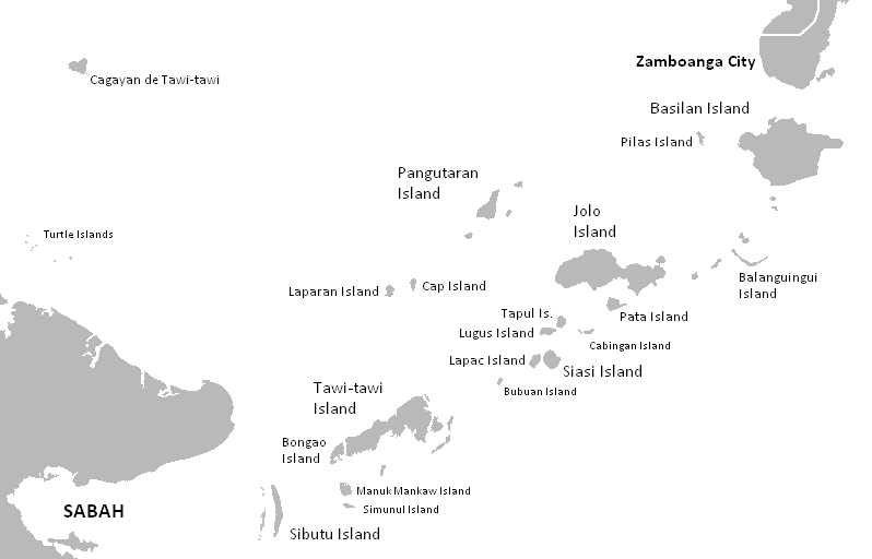
Sulu_archipelago.png (798 × 512 pixels, size sa payl: 22 KB, MIME type: image/png)
Mubong sugid:
| Deskripsyon | Location map of Sulu Archipelago |
| Petsa | |
| Gigikanan | The Coffee's Blank map of the Philippines |
| Tagsulat | Kleomarlo |
- Other information
English: Sulu Archipelago
Pagtugot
| I, the copyright holder of this work, release this work into the public domain. This applies worldwide. In some countries this may not be legally possible; if so: I grant anyone the right to use this work for any purpose, without any conditions, unless such conditions are required by law. |
Kaagi sa payl
I-klik ang petsa/oras aron makit-an ang hulagway sa payl niadtong panahona.
| Petsa/Takna | Thumbnail | Mga dimensyon | Tiggamit | Komento | |
|---|---|---|---|---|---|
| kasamtangan | 12:34, 9 Mayo 2008 | | 798 × 512 (22 KB) | Kleomarlo | {{Information |Description=Location map of Sulu Archipelago |Source=The Coffee's Blank map of the Philippines |Date=May 8, 2008 |Author= Kleomarlo |Permission= |other_versions= }} |
Mga paggamit sa payl
Ang mosunod nga mga panid misumpay niining payl:
Global nga paggamit sa payl
Kining ubang wiki naggamit ning maong payl:
- Paggamit sa ar.wikipedia.org
- Paggamit sa ast.wikipedia.org
- Paggamit sa azb.wikipedia.org
- Paggamit sa az.wikipedia.org
- Paggamit sa ca.wikipedia.org
- Paggamit sa cs.wikipedia.org
- Paggamit sa de.wikipedia.org
- Paggamit sa en.wikipedia.org
- Paggamit sa en.wikivoyage.org
- Paggamit sa es.wikipedia.org
- Paggamit sa eu.wikipedia.org
- Paggamit sa fa.wikipedia.org
- Paggamit sa frr.wikipedia.org
- Paggamit sa fr.wikipedia.org
- Paggamit sa gl.wikipedia.org
- Paggamit sa hi.wikipedia.org
- Paggamit sa hr.wikipedia.org
- Paggamit sa hu.wikipedia.org
- Paggamit sa ilo.wikipedia.org
- Paggamit sa incubator.wikimedia.org
- Paggamit sa is.wikipedia.org
- Paggamit sa it.wikipedia.org
- Paggamit sa ja.wikipedia.org
- Paggamit sa ka.wikipedia.org
- Paggamit sa ko.wikipedia.org
- Paggamit sa mrj.wikipedia.org
- Paggamit sa mt.wikipedia.org
- Paggamit sa nl.wikipedia.org
- Paggamit sa nn.wikipedia.org
- Paggamit sa no.wikipedia.org
- Paggamit sa pl.wikipedia.org
- Paggamit sa pt.wikipedia.org
- Paggamit sa ro.wikipedia.org
- Paggamit sa ru.wikipedia.org
- Paggamit sa species.wikimedia.org
- Paggamit sa sv.wikipedia.org
- Paggamit sa ta.wikinews.org
- Paggamit sa tr.wikipedia.org
View more global usage of this file.