
Payl:The Square, Crynant - geograph.org.uk - 201005.jpg
Walay mas taas nga resolusyon.
The_Square,_Crynant_-_geograph.org.uk_-_201005.jpg (640 × 443 pixels, size sa payl: 170 KB, MIME type: image/jpeg)
Mubong sugid:
| Deskripsyon |
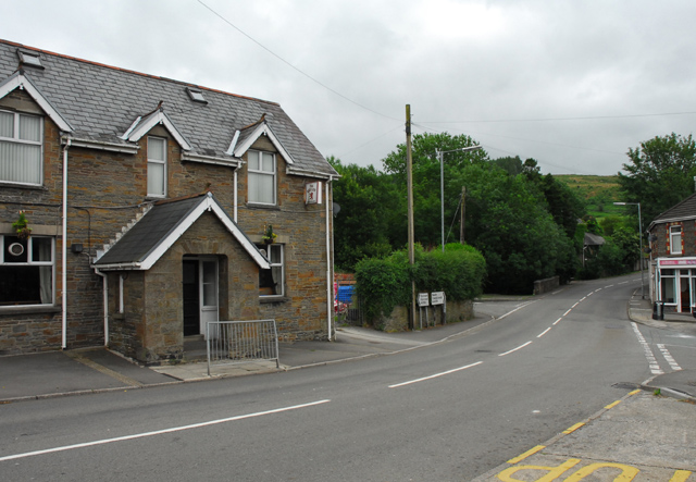
English: The Square, Crynant. The A4109 road through the Dulais Valley. The public house to the left is 'The Red Lion' |
| Petsa | |
| Gigikanan | From geograph.org.uk |
| Tagsulat | Cedwyn Davies |
| Attribution (required by the license) | Cedwyn Davies / The Square, Crynant / |
| Camera location | | View this and other nearby images on: OpenStreetMap |
|---|
_heading:135.00&language=ceb)
| Object location | | View this and other nearby images on: OpenStreetMap |
|---|
_heading:135.00&language=ceb)
Pagtugot

|
This image was taken from the Geograph project collection. See this photograph's page on the Geograph website for the photographer's contact details. The copyright on this image is owned by Cedwyn Davies and is licensed for reuse under the Creative Commons Attribution-ShareAlike 2.0 license.
|
This file is licensed under the Creative Commons Attribution-Share Alike 2.0 Generic license.
Attribution: Cedwyn Davies
- Libre ka:
- sa pagsabwag – sa pagkopya, pag-apod-apod ug pagsabwag sa hinimo
- sa pag-remix – sa pag-adap sa binuhat
- Ubos sa mosunod nga mga kondisyon:
- atribusyon – Kinahanglan nimo nga hatagan ang angay nga kredito, maghatag usa ka link sa lisensya, ug ipakita kung adunay mga pagbag-o. Mahimo nimo kini buhaton sa bisan unsang makatarunganon nga paagi, apan dili sa bisan unsang paagi nga nagsugyot nga gi-endorso ka sa licensor o ang imong paggamit.
- share parehas – Kung imong gi-remix, gibag-o, o gibase sa materyal, kinahanglan nimo nga iapod-apod ang imong mga kontribusyon sa ilawom sa parehas o katugma nga lisensya sama sa orihinal.
- Remove redundant categories and try to put this image in the most specific category/categories
- Remove this template
- The location categories are based on information from this geonames tool and this OpenStreetMap tool combined with a database. You can also have a look at this tool from mysociety.
- The topic category from Geograph was Road (find similar images at Geograph)
Kaagi sa payl
I-klik ang petsa/oras aron makit-an ang hulagway sa payl niadtong panahona.
| Petsa/Takna | Thumbnail | Mga dimensyon | Tiggamit | Komento | |
|---|---|---|---|---|---|
| kasamtangan | 21:58, 31 Enero 2010 | | 640 × 443 (170 KB) | GeographBot | == {{int:filedesc}} == {{Information |description={{en|1=The Square, Crynant. The A4109 road through the Dulais Valley. The public house to the left is 'The Red Lion'}} |date=2006-07-12 |source=From [http://www.geograph.org.uk/photo/201005 geograph.org.uk |
Mga paggamit sa payl
Ang mosunod nga mga panid misumpay niining payl:
Global nga paggamit sa payl
Kining ubang wiki naggamit ning maong payl:
- Paggamit sa cy.wikipedia.org
- Paggamit sa en.wikipedia.org
- Paggamit sa es.wikipedia.org
- Paggamit sa eu.wikipedia.org
- Paggamit sa fr.wikipedia.org
- Paggamit sa ga.wikipedia.org
- Paggamit sa gd.wikipedia.org
- Paggamit sa it.wikipedia.org
- Paggamit sa kw.wikipedia.org
- Paggamit sa sv.wikipedia.org
- Paggamit sa www.wikidata.org
- Paggamit sa zh-min-nan.wikipedia.org