
Payl:USA Utah location map.svg

Size of this PNG preview of this SVG file: 505 x 600 ka mga piksel. Uban pang mga resoluyon: 202 x 240 ka mga piksel | 404 x 480 ka mga piksel | 647 x 768 ka mga piksel | 862 x 1,024 ka mga piksel | 1,724 x 2,048 ka mga piksel | 868 x 1,031 ka mga piksel.
Tibuok resolusyon (SVG nga payl, nominally 868 × 1,031 pixels, size sa payl: 175 KB)
Mubong sugid:
| Deskripsyon |
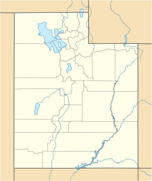
Quadratische Plattkarte, N-S-Streckung 125 %. Geographische Begrenzung der Karte:
Equirectangular projection, N/S stretching 125 %. Geographic limits of the map:
|
| Petsa | 09-06-2009 |
| Gigikanan |
own work, using
|
| Tagsulat | NordNordWest |
| Other versions |
Derivative works of this file: |

|
This map has been made or improved in the German Kartenwerkstatt (Map Lab). You can propose maps to improve as well.
|
Pagtugot
I, the copyright holder of this work, hereby publish it under the following licenses:

|
Gitugot ang pagkopya, pag-apud-apod o/ug pag-usab ning maong dokumento ubos sa mga termino sa GNU Free Documentation License, Version 1.2 o mas bag-ong bersiyon nga gimantala sa Free Software Foundation; nga walay Invariant Sections, walay Front-Cover Texts, ug walay Back-Cover Texts. Ang kopya sa lisensiya gilakip sa bahin nga giulohang GNU Free Documentation License. |
This file is licensed under the Creative Commons Attribution 3.0 Unported license.
- Libre ka:
- sa pagsabwag – sa pagkopya, pag-apod-apod ug pagsabwag sa hinimo
- sa pag-remix – sa pag-adap sa binuhat
- Ubos sa mosunod nga mga kondisyon:
- atribusyon – Kinahanglan nimo nga hatagan ang angay nga kredito, maghatag usa ka link sa lisensya, ug ipakita kung adunay mga pagbag-o. Mahimo nimo kini buhaton sa bisan unsang makatarunganon nga paagi, apan dili sa bisan unsang paagi nga nagsugyot nga gi-endorso ka sa licensor o ang imong paggamit.
You may select the license of your choice.
Kaagi sa payl
I-klik ang petsa/oras aron makit-an ang hulagway sa payl niadtong panahona.
| Petsa/Takna | Thumbnail | Mga dimensyon | Tiggamit | Komento | |
|---|---|---|---|---|---|
| kasamtangan | 15:34, 15 Hunyo 2015 | | 868 × 1,031 (175 KB) | NordNordWest | Reverted to version as of 12:08, 12 December 2010; please upload it as a new file |
| 14:48, 15 Hunyo 2015 |  | 868 × 1,031 (289 KB) | Prinsgezinde | Reverted to version as of 14:44, 15 June 2015 | |
| 14:47, 15 Hunyo 2015 |  | 868 × 1,031 (289 KB) | Prinsgezinde | As per revert | |
| 14:44, 15 Hunyo 2015 |  | 868 × 1,031 (289 KB) | Prinsgezinde | Reverted to version as of 06:39, 12 December 2010 - Unhelpful revert, change was requested and is appreciated | |
| 12:08, 12 Disyembre 2010 |  | 868 × 1,031 (175 KB) | NordNordWest | no discussion, no change | |
| 06:39, 12 Disyembre 2010 |  | 868 × 1,031 (289 KB) | Moabdave | Added inset to show location of Utah. Inset derived from File:Map_of_USA_UT.svg. Change made per request at FAC for en:Thistle Utah. | |
| 18:09, 9 Hunyo 2009 |  | 868 × 1,031 (175 KB) | NordNordWest | {{Information |Description= {{de|Positionskarte von Utah, USA}} Quadratische Plattkarte, N-S-Streckung 125 %. Geographische Begrenzung der Karte: * N: 42.4° N * S: 36.6° N * W: 114.6° W * O: 108.5° W {{en|Location map of [[:en |
Mga paggamit sa payl
Ang mosunod nga 2 panid misumpay niining payl:
Global nga paggamit sa payl
Kining ubang wiki naggamit ning maong payl:
- Paggamit sa an.wikipedia.org
- Paggamit sa ar.wikipedia.org
- Paggamit sa ast.wikipedia.org
- Paggamit sa azb.wikipedia.org
- کانیون ریم
- ولف کریک، یوتا
- اقنوق، یوتا
- بالفراق، یوتا
- بریل، یوتا
- داک کریک ویلج، یوتا
- لاپوینت، یوتا
- ماونت کارمل جانکشن، یوتا
- اسکدیل، یوتا
- باربانک، یوتا
- مودنا، یوتا
- لاند، یوتا
- قروور، یوتا
- بلومینقتون، یوتا
- کرویدون، یوتا
- وست وبر، یوتا
- قرینویل، یوتا
- کالاو، یوتا
- آدامزویل، یوتا
- مونتاین هوم، یوتا
- آجاکس، یوتا
- واهساچ، یوتا
- تالمئیج، یوتا
- آلتامونت، یوتا
- وارن، یوتا
- واشاکی، یوتا
- آلتوناه، یوتا
- ترئیس، یوتا
- آلونیت، یوتا
- آمریکان فورک، یوتا
- تیکابو، یوتا
- آپل والئی، یوتا
- ورای، یوتا
- آورورا، یوتا
- آکستل، یوتا
- امیقراشن کانیون، یوتا
- پارک والئی، یوتا
- پارتون، یوتا
- تریدل، یوتا
- تروت کریک، یوتا
- وزت والئی سیتی، یوتا
- پنروز، یوتا
- توکر، یوتا
- پترزون، یوتا
View more global usage of this file.