
Payl:Village Sign, Robertsbridge - geograph.org.uk - 1731097.jpg
Village_Sign,_Robertsbridge_-_geograph.org.uk_-_1731097.jpg (640 × 430 pixels, size sa payl: 145 KB, MIME type: image/jpeg)
Mubong sugid:
| Deskripsyon |
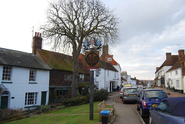
English: Village Sign, Robertsbridge Robertsbridge
Robertsbridge is a village in East Sussex, England within the civil parish of Salehurst and Robertsbridge. It is approximately ten miles (16 km) north of Hastings and thirteen miles (21 km) south-east of Tunbridge Wells. The River Rother passes through the village. The village is thought to date back to 1176 when a Cistercian abbey was founded there by the Abbot, Robert de St Martin. When a market charter was granted in 1198 by Richard I to 'Robertsbridge' (Pons Roberti in Latin) it was the first recorded use of the name. The abbey was dissolved in 1538; however, the town flourished, and many of the oldest existing houses in the village date from the 14th and 15th centuries, including The Seven Stars Inn on the historic High Street. Robertsbridge is also home to the Robertsbridge Codex (1360), a music manuscript of the 14th century. It contains the earliest surviving music written specifically for keyboard. Robertsbridge is well served by transport links with the Robertsbridge station on the main railway line from Hastings to London and the A21 trunk road, although the latter has problems with transport delays. The opening of the Robertsbridge bypass, in 1989, relieved the village of constant traffic through it. Robertsbridge Community College, a specialist Mathematics and Computer college, is the smallest such in the county of East Sussex. Also, as well as the secondary school in the village, there is a primary school (Salehurst Church of England Primary), a school with an exceedingly good reputation throughout the area. Among sports clubs is the Robertsbridge Rugby Football Club. |
| Petsa | |
| Gigikanan | From geograph.org.uk |
| Tagsulat | Nigel Chadwick |
| Camera location | | View this and other nearby images on: OpenStreetMap |
|---|
_heading:0.00&language=ceb)
| Object location | | View this and other nearby images on: OpenStreetMap |
|---|
_heading:0.00&language=ceb)
Pagtugot

|
This image was taken from the Geograph project collection. See this photograph's page on the Geograph website for the photographer's contact details. The copyright on this image is owned by Nigel Chadwick and is licensed for reuse under the Creative Commons Attribution-ShareAlike 2.0 license.
|
- Libre ka:
- sa pagsabwag – sa pagkopya, pag-apod-apod ug pagsabwag sa hinimo
- sa pag-remix – sa pag-adap sa binuhat
- Ubos sa mosunod nga mga kondisyon:
- atribusyon – Kinahanglan nimo nga hatagan ang angay nga kredito, maghatag usa ka link sa lisensya, ug ipakita kung adunay mga pagbag-o. Mahimo nimo kini buhaton sa bisan unsang makatarunganon nga paagi, apan dili sa bisan unsang paagi nga nagsugyot nga gi-endorso ka sa licensor o ang imong paggamit.
- share parehas – Kung imong gi-remix, gibag-o, o gibase sa materyal, kinahanglan nimo nga iapod-apod ang imong mga kontribusyon sa ilawom sa parehas o katugma nga lisensya sama sa orihinal.
Kaagi sa payl
I-klik ang petsa/oras aron makit-an ang hulagway sa payl niadtong panahona.
| Petsa/Takna | Thumbnail | Mga dimensyon | Tiggamit | Komento | |
|---|---|---|---|---|---|
| kasamtangan | 17:07, 5 Marso 2011 | | 640 × 430 (145 KB) | GeographBot | == {{int:filedesc}} == {{Information |description={{en|1=Village Sign, Robertsbridge Robertsbridge Robertsbridge is a village in East Sussex, England within the civil parish of Salehurst and Robertsbridge. It is approximately ten miles (16 km) north of H |
Mga paggamit sa payl
Ang mosunod nga mga panid misumpay niining payl:
Global nga paggamit sa payl
Kining ubang wiki naggamit ning maong payl:
- Paggamit sa en.wikipedia.org
- Paggamit sa fr.wikipedia.org
- Paggamit sa nl.wikipedia.org
- Paggamit sa sv.wikipedia.org
- Paggamit sa www.wikidata.org