
Payl:Zimbabwe location map.svg

Size of this PNG preview of this SVG file: 661 x 600 ka mga piksel. Uban pang mga resoluyon: 265 x 240 ka mga piksel | 529 x 480 ka mga piksel | 846 x 768 ka mga piksel | 1,128 x 1,024 ka mga piksel | 2,257 x 2,048 ka mga piksel | 832 x 755 ka mga piksel.
Tibuok resolusyon (SVG nga payl, nominally 832 × 755 pixels, size sa payl: 193 KB)
Mubong sugid:
| Deskripsyon |
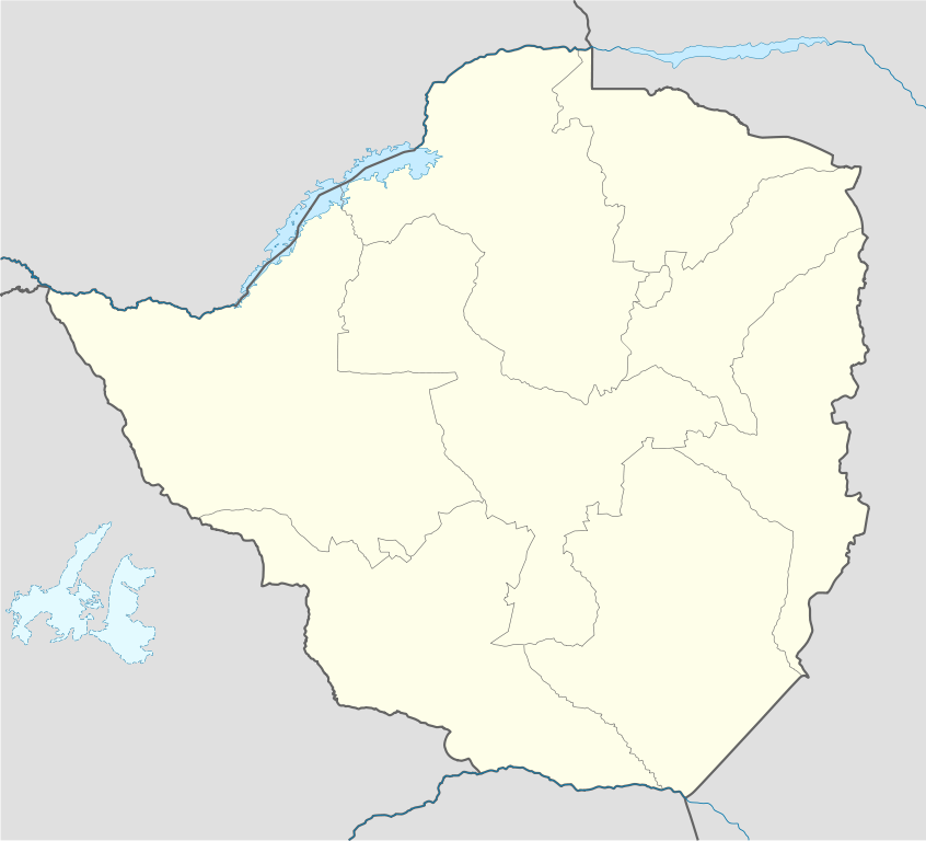
Deutsch: Positionskarte von Simbabwe
Quadratische Plattkarte, N-S-Streckung 105 %. Geographische Begrenzung der Karte:
English: Location map of Zimbabwe
Equirectangular projection, N/S stretching 105 %. Geographic limits of the map:
|
| Petsa | |
| Gigikanan |
own work, using
|
| Tagsulat | NordNordWest |
| Other versions |
|


|
This map has been made or improved in the German Kartenwerkstatt (Map Lab). You can propose maps to improve as well.
|
Pagtugot
I, the copyright holder of this work, hereby publish it under the following licenses:

|
Gitugot ang pagkopya, pag-apud-apod o/ug pag-usab ning maong dokumento ubos sa mga termino sa GNU Free Documentation License, Version 1.2 o mas bag-ong bersiyon nga gimantala sa Free Software Foundation; nga walay Invariant Sections, walay Front-Cover Texts, ug walay Back-Cover Texts. Ang kopya sa lisensiya gilakip sa bahin nga giulohang GNU Free Documentation License. |
This file is licensed under the Creative Commons Attribution-Share Alike 3.0 Unported license.
- Libre ka:
- sa pagsabwag – sa pagkopya, pag-apod-apod ug pagsabwag sa hinimo
- sa pag-remix – sa pag-adap sa binuhat
- Ubos sa mosunod nga mga kondisyon:
- atribusyon – Kinahanglan nimo nga hatagan ang angay nga kredito, maghatag usa ka link sa lisensya, ug ipakita kung adunay mga pagbag-o. Mahimo nimo kini buhaton sa bisan unsang makatarunganon nga paagi, apan dili sa bisan unsang paagi nga nagsugyot nga gi-endorso ka sa licensor o ang imong paggamit.
- share parehas – Kung imong gi-remix, gibag-o, o gibase sa materyal, kinahanglan nimo nga iapod-apod ang imong mga kontribusyon sa ilawom sa parehas o katugma nga lisensya sama sa orihinal.
You may select the license of your choice.
Kaagi sa payl
I-klik ang petsa/oras aron makit-an ang hulagway sa payl niadtong panahona.
| Petsa/Takna | Thumbnail | Mga dimensyon | Tiggamit | Komento | |
|---|---|---|---|---|---|
| kasamtangan | 17:49, 13 Agosto 2008 | | 832 × 755 (193 KB) | NordNordWest | {{Information |Description= {{de|Positionskarte von Simbabwe}} Quadratische Plattkarte, N-S-Streckung 105 %. Geographische Begrenzung der Karte: * N: 15.2° S * S: 22.8° S * W: 24.8° O * O: 33.6° O {{en|Location map of [[:en:Zimbabwe|Z |
Mga paggamit sa payl
More than 100 pages use this file. The following list shows the first 100 pages that use this file only. A full list is available.
- Aha
- Anna (pagklaro)
- Baba
- Banda
- Banga
- Banji
- Bira
- Biri
- Blue Hills
- Boma
- Bonanza
- Bongo
- Borera
- Cam
- Cave
- Chara (pagklaro)
- Chimborazo
- Chito
- Damba
- Danga
- Donge
- Dora
- Dula
- Dunje
- Duri
- Duru
- Flora
- Honga
- Horse Shoe
- Jama
- Kabanga
- Kachinga
- Kala
- Kamara
- Kana (pagklaro)
- Kapata
- Kariba
- Karibu
- Karimba
- Kula
- Loma
- Lukala
- Luke
- Lunga
- Magudu
- Manama
- Manga (pagklaro)
- Mangondi
- Maramba
- Mari
- Matanga
- Mawu
- Membwe
- Mongwa
- Mpanda
- Mugonera
- Muhwima
- Mukombe
- Mukungwe
- Muramba
- Murembwe
- Murera
- Musasa
- Mutsinda
- Namara
- Ndanga
- Ngoma (pagklaro)
- Ngonya
- Nouni
- Nyakarangara
- Nyambwa
- Nyamini
- Nyampanda
- Nyangoma
- Nyangwa
- Nyati
- Nyunga
- Nyungwe
- Panga
- Patika
- Rasa
- Remera
- Rouge
- Rungu
- Rutenga
- Saint George
- Sango
- Seti
- Shaga
- Shanga
- Simba
- Sorwe
- Tamba (pagklaro)
- Teme
- Umbusi
- Unity
- Ura
- Victoria
- Virginia
- Wawa
View more links to this file.
Global nga paggamit sa payl
Kining ubang wiki naggamit ning maong payl:
- Paggamit sa af.wikipedia.org
- Paggamit sa am.wikipedia.org
- Paggamit sa ar.wikipedia.org
- Paggamit sa az.wikipedia.org
- Paggamit sa ba.wikipedia.org
- Paggamit sa be-tarask.wikipedia.org
- Paggamit sa be.wikipedia.org
- Paggamit sa bg.wikipedia.org
- Paggamit sa bn.wikipedia.org
- Paggamit sa bs.wikipedia.org
- Paggamit sa ce.wikipedia.org
- Paggamit sa ckb.wikipedia.org
- Paggamit sa cs.wikipedia.org
- Paggamit sa da.wikipedia.org
View more global usage of this file.