
Payl:Åland location map.svg

Size of this PNG preview of this SVG file: 595 x 600 ka mga piksel. Uban pang mga resoluyon: 238 x 240 ka mga piksel | 476 x 480 ka mga piksel | 762 x 768 ka mga piksel | 1,016 x 1,024 ka mga piksel | 2,032 x 2,048 ka mga piksel | 996 x 1,004 ka mga piksel.
Tibuok resolusyon (SVG nga payl, nominally 996 × 1,004 pixels, size sa payl: 185 KB)
| Deskripsyon |
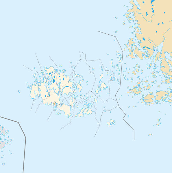
Deutsch: Positionskarte der Åland Quadratische Plattkarte, N-S-Streckung 100 %, Geographische Begrenzung der Karte: * N: 61.0° N * S: 59.5° N * W: 19.0° O * O: 22.0° O Français : Carte de géolocalisation de l'État libre associé d'Åland en projection équirectangulaire, coordonnées extrêmes de la carte: * N: 61.0° N * S: 59.5° N * W: 19.0° E * O: 22.0° E |
| Petsa | (UTC) |
| Gigikanan | |
| Tagsulat |
|
| This is a retouched picture, which means that it has been digitally altered from its original version. The original can be viewed here: Åland Political Map-blank.svg:
|
I, the copyright holder of this work, hereby publish it under the following licenses:
This file is licensed under the Creative Commons Attribution-Share Alike 3.0 Unported, 2.5 Generic, 2.0 Generic and 1.0 Generic license.
- Libre ka:
- sa pagsabwag – sa pagkopya, pag-apod-apod ug pagsabwag sa hinimo
- sa pag-remix – sa pag-adap sa binuhat
- Ubos sa mosunod nga mga kondisyon:
- atribusyon – Kinahanglan nimo nga hatagan ang angay nga kredito, maghatag usa ka link sa lisensya, ug ipakita kung adunay mga pagbag-o. Mahimo nimo kini buhaton sa bisan unsang makatarunganon nga paagi, apan dili sa bisan unsang paagi nga nagsugyot nga gi-endorso ka sa licensor o ang imong paggamit.
- share parehas – Kung imong gi-remix, gibag-o, o gibase sa materyal, kinahanglan nimo nga iapod-apod ang imong mga kontribusyon sa ilawom sa parehas o katugma nga lisensya sama sa orihinal.

|
Gitugot ang pagkopya, pag-apud-apod o/ug pag-usab ning maong dokumento ubos sa mga termino sa GNU Free Documentation License, Version 1.2 o mas bag-ong bersiyon nga gimantala sa Free Software Foundation; nga walay Invariant Sections, walay Front-Cover Texts, ug walay Back-Cover Texts. Ang kopya sa lisensiya gilakip sa bahin nga giulohang GNU Free Documentation License. |
You may select the license of your choice.
Original upload log
This image is a derivative work of the following images:
- File:Åland_Political_Map-blank.svg licensed with Cc-by-sa-3.0,2.5,2.0,1.0, GFDL
- 2007-08-21T16:27:02Z Sémhur 996x1004 (200777 Bytes) {{Information |Description= {{en|Political blank map of the autonomous finnish province of [[:en:Åland|Åland]]. Shows the national, regional and municipal boundaries about Åland islands.}} {{fr|Carte politique de l'État l
Uploaded with derivativeFX
Kaagi sa payl
I-klik ang petsa/oras aron makit-an ang hulagway sa payl niadtong panahona.
| Petsa/Takna | Thumbnail | Mga dimensyon | Tiggamit | Komento | |
|---|---|---|---|---|---|
| kasamtangan | 13:14, 23 Hulyo 2010 | | 996 × 1,004 (185 KB) | Xfigpower | {{Information |Description={{de|1=Positionskarte der Åland Quadratische Plattkarte, N-S-Streckung 100 %, Geographische Begrenzung der Karte: * N: ???° N * S: ???° N * W: ???° W * O: ???° W}} {{en|1=Carte de géolocalisation de l'État |
Mga paggamit sa payl
More than 100 pages use this file. The following list shows the first 100 pages that use this file only. A full list is available.
- Adoe
- Badan
- Baro
- Basto
- Bredan
- Ekholm
- Gadden
- Geto
- Gollan
- Granholm
- Grano
- Haren
- Hogan
- Hundskar
- Järsöfjärden
- Kakan
- Kalen
- Kalkgrund
- Kalvholmen
- Kasberg
- Lagan
- Lango
- Långskär
- Nato
- Nygrund
- Platen
- Pungo
- Sando
- Sandören
- Skaret
- Skarven
- Sottunga
- Stenskar
- Stenskär
- Stora Lökskär
- Stora Sandören
- Stora Sundskär
- Storfjarden
- Storfjärd
- Storfjärden
- Storgadden
- Storgrund
- Storgrundet
- Storharun
- Storholm
- Storholmen
- Storklobben
- Storklubb
- Storklubben
- Storlandet
- Storrevet
- Storskar
- Storskaret
- Storskär
- Storskäret
- Styrskär
- Sund
- Sundskar
- Sundskär
- Svartbadan
- Svartbådan
- Svartholm
- Svartstenarna
- Sviskär
- Synderskär
- Synderstö
- Tjurgrund
- Tofto
- Torngrund
- Torsholm
- Torsholma
- Träskholm
- Träskskär
- Tullskär
- Valo
- Valoe
- Vardo
- Vardoe
- Vargskär
- Vasterfjarden
- Vasteron
- Vesterö
- Vidskär
- Viggskär
- Vikarskären
- Vikskär
- Vitfågelskär
- Vitklobbarna
- Vro
- Väderskär
- Västerfjärden
- Västerö
- Västerön
- Vålö
- Vårdö
- Ytteroen
- Ytterskär
- Ytterö
- Ytterön
- Yxskär
View more links to this file.
Global nga paggamit sa payl
Kining ubang wiki naggamit ning maong payl:
- Paggamit sa an.wikipedia.org
- Paggamit sa ar.wikipedia.org
- Paggamit sa cs.wikipedia.org
- Paggamit sa da.wikipedia.org
- Paggamit sa de.wikipedia.org
- Paggamit sa de.wikivoyage.org
- Paggamit sa en.wikipedia.org
- Paggamit sa eo.wikipedia.org
- Paggamit sa es.wikipedia.org
- Paggamit sa et.wikipedia.org
- Paggamit sa fa.wikipedia.org
View more global usage of this file.