Alpine (rehiyon)
Paghimo ni bot Lsjbot. |
- Alang sa ubang mga dapit sa mao gihapon nga ngalan, tan-awa ang Alpine.
| Alpine | |
| Rehiyon | |
| Nasod | |
|---|---|
| Estado | State of Victoria |
| Gitas-on | 520 m (1,706 ft) |
| Tiganos | 36°50′03″S 146°58′46″E / 36.83412°S 146.97936°E |
| Population | 12,044 (2014-07-26) [1] |
| Timezone | AEST (UTC+10) |
| - summer (DST) | AEDT (UTC+11) |
| GeoNames | 7839525 |
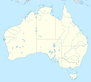
Rehiyon ang Alpine sa Ostralya.[1] Nahimutang ni sa estado sa State of Victoria, sa habagatan-sidlakang bahin sa nasod, 260 km sa habagatan-kasadpan sa Canberra ang ulohan sa nasod. Adunay 12,044 ka molupyo.[1]
Mga lungsod sa Alpine:
Sa mosunod nga mga natural nga mga bahin makita sa Alpine:
- Mga suba:
- Mga lanaw:
- Mga bungtod:
- Apex Lookout (bungtod)
- Bald Hill (bungtod)
- Bald Hill (bungtod)
- Basalt Knob (bungtod)
- Basalt Temple (bungtod)
- Beecher Hill (bungtod)
- Big Dipper (bungtod)
- Billsons Lookout (bungtod)
- Blue Hills (bungtod)
- Bogong Hill (bungtod)
- Bon Accord Hill (bungtod)
- Boulder Knob (bungtod)
- C R B Hills (bungtod)
- Clearspot Lookout (bungtod)
- Cobungra Hill (bungtod)
- Damsite Hill (bungtod)
- Dead Timber Hill (bungtod)
- Echo Point (bungtod)
- Goat Knob (bungtod)
- Green Hill (bungtod)
- High Knob (bungtod)
- High Point (bungtod)
- Huggins Lookout (bungtod)
- Lookout Hill (bungtod)
- Lyrebird Hill (bungtod)
- Marriotts Lookout (bungtod)
- Masterton Hill (bungtod)
- Moore Hill (bungtod)
- North Peak (bungtod)
- Nug Nug Hills (bungtod)
- Og Gog Magog (bungtod)
- Paddy Hill (bungtod)
- Pumice Hill (bungtod)
- Pyramid Hill (bungtod)
- Queen Victoria Pinnicle (bungtod)
- Reeds Lookout (bungtod)
- Rocky Knobs (bungtod)
- Sharpe Hill (bungtod)
- Sugarloaf Hill (bungtod)
- The Costitution (bungtod)
- The Grey Hills (bungtod)
- Tower Hill (bungtod)
- Ulrich Hill (bungtod)
- Wallaby Hill (bungtod)
- White Hill (bungtod)
- Wilfred Hill (bungtod)
- Kabukiran:
- Anderson Peak (tumoy sa bukid)
- Big Hill (bukid)
- Crowsnest (bukid)
- Eagle Peak (tumoy sa bukid)
- Eagle Point (tumoy sa bukid)
- Ebenezer Mount (bukid)
- Little Mount Bogong (bukid)
- Little Mount Emu (bukid)
- Little Spion Kopje (bukid)
- Mount Angus (bukid)
- Mount Beauty (bukid)
- Mount Bluerag (bukid)
- Mount Bogong (bukid)
- Mount Buffalo (bukid)
- Mount Buggery (bukid)
- Mount Bundara (bukid)
- Mount Cope (bukid)
- Mount Despair (bukid)
- Mount Dunn (bukid)
- Mount Emu (bukid)
- Mount Emu (bukid)
- Mount Fainter (bukid)
- Mount Fainter North (bukid)
- Mount Fainter South (bukid)
- Mount Feathertop (bukid)
- Mount Freezeout (bukid)
- Mount Jack (bukid)
- Mount Jim (bukid)
- Mount Little Arthur (bukid)
- Mount Little Blowhard (bukid)
- Mount Loch (bukid)
- Mount Mary (bukid)
- Mount Mciver (bukid)
- Mount Mcleod (bukid)
- Mount Murray (bukid)
- Mount Niggerhead (bukid)
- Mount Porepunkah (bukid)
- Mount Sarah (bukid)
- Mount Selwyn (bukid)
- Mount Smythe (bukid)
- Mount Tabletop (bukid)
- Mount Towonga (bukid)
- South Selwyn (bukid)
- South Viking (bukid)
- Spion Kopje (bukid)
- Square Mount (bukid)
- Sugar Loaf (bukid)
- The Horn (bukid)
- The Hump (bukid)
- The Twins (bukid)
- West Peak (tumoy sa bukid)
Hapit nalukop sa lasang ang palibot sa Alpine.[2] Dunay mga 4 ka tawo kada kilometro kwadrado sa palibot sa Alpine may kaayo gamay nga populasyon.[3] Ang klima baybayon.[4] Ang kasarangang giiniton 11 °C. Ang kinainitan nga bulan Enero, sa 20 °C, ug ang kinabugnawan Hulyo, sa 2 °C.[5] Ang kasarangang pag-ulan 1,512 milimetro matag tuig. Ang kinabasaan nga bulan Hulyo, sa 183 milimetro nga ulan, ug ang kinaugahan Enero, sa 46 milimetro.[6]
| ||||||||||||||||||||||||||||||||||||||||||||||||||||||||||||||||||||||||||||||||||||||||||||||||||||||||||||||||||||||||||||
Ang mga gi basihan niini[usba | usba ang wikitext]
- ↑ 1.0 1.1 1.2 Alpine sa GeoNames.Org (cc-by); post updated 2014-07-26; database download sa 2015-06-27
- ↑ "NASA Earth Observations: Land Cover Classification". NASA/MODIS. Retrieved 30 Enero 2016.
- ↑ "NASA Earth Observations: Population Density". NASA/SEDAC. Retrieved 30 Enero 2016.
- ↑ Peel, M C; Finlayson, B L. "Updated world map of the Köppen-Geiger climate classification". Hydrology and Earth System Sciences. 11: 1633–1644. doi:10.5194/hess-11-1633-2007. Retrieved 30 Enero 2016.
{{cite journal}}: CS1 maint: unflagged free DOI (link) - ↑ 5.0 5.1 "NASA Earth Observations Data Set Index". NASA. Retrieved 30 Enero 2016.
- ↑ "NASA Earth Observations: Rainfall (1 month - TRMM)". NASA/Tropical Rainfall Monitoring Mission. Retrieved 30 Enero 2016.


