
Plantilya:Geobox locator Australia/doc
| This is a documentation subpage for Plantilya:Terminate sentence It may contain usage information, categories and other content that is not part of the original plantilya page. |
This template is used within Template:Geobox map and Template:Geobox2 map, supportive templates for various infoboxes from the Category:Geobox series.
Maps using this calibration[usba ang wikitext]
-
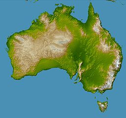
Topography of australia.jpg -

Australia - outline map.svg

Geobox usage[usba ang wikitext]
When using this locator system in {{Geobox}}, you will typically want to use the below code which layers the two images below on top of each other.
<!-- *** Maps *** -->
| map = Australia - outline map.svg
| map_background = Topography of australia.jpg
| map_locator = Australia
| map_caption = Location in Australia
Example[usba ang wikitext]
| Uluru | |
| Ayers Rock | |
| Tiganos | 25°20′42″S 131°02′10″E / 25.34500°S 131.03611°E |
|---|---|
  Location in Australia
| |
{{Geobox
| name = Uluru
| other_name = Ayers Rock
| lat_d  =  25 | lat_m  = 20 | lat_s  = 42 | lat_NS  = S
| long_d = 131 | long_m = 02 | long_s = 10 | long_EW = E
| map = Australia - outline map.svg
| map_background = Topography of australia.jpg
| map_locator = Australia
| map_caption = Location in Australia
}}

Same coordinates displayed via {{Location map}}
See also[usba ang wikitext]
- Template:Geobox locator Australia New South Wales
- Template:Geobox locator Australia Victoria
- Template:Location map Australia, a map definition for Template:Location map (used by {{Infobox settlement}}, {{Infobox mountain}}, etc.)